
Apple Maps has gotten undeniably better in recent years. But there’s still no denying that Google Maps remains the best mapping app available today. This, of course, shouldn’t come as too much of a surprise given that Google Maps was released all the way back in February of 2005, a good seven years before Apple Maps made its debut. Over the last 16-plus years, Google has managed to incorporate a bevy of cool features into its mapping software. One example of a Google Maps feature you might not be aware of even helps prevent you from getting a dreaded traffic ticket.
Google Maps Speed trap feature
Few things in life are more aggravating than getting a ticket for speeding. Now, of course, you can avoid speeding tickets entirely by simply obeying the speed limit. Still, the reality is that everyone tends to speed on occasion, especially when traffic is light and everyone else is cruising at 5-10 MPH above the limit.
If you fall into this category, you might be wholly unaware that Google Maps has a feature that alerts you when a speed trap is on your route. A speed trap, as a quick primer, is an area alongside a highway where police sit conspicuously and monitor how fast people are going.
Google Maps, however, has a feature that alerts users where some of these speed traps are located. To check out the feature, simply open up Google Maps and enter your destination. If there are noted speed traps on the route, you’ll see a blue megaphone icon.
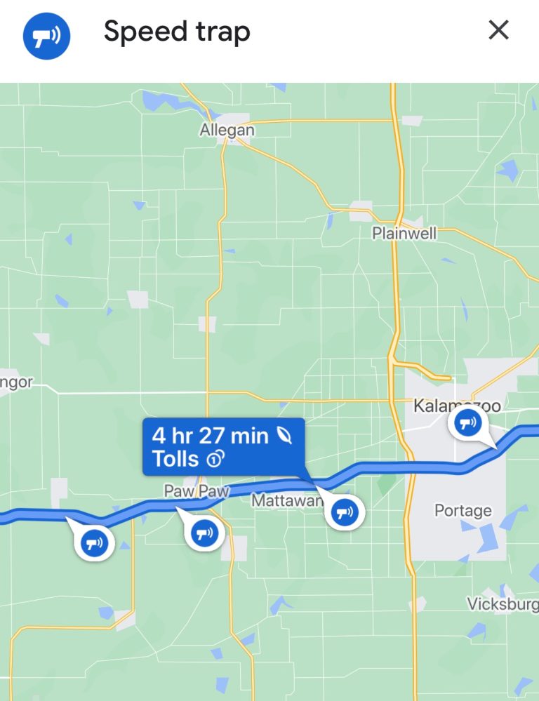
As an example, I looked up the driving route from New York to Wisconsin. Along the way, Google Maps alerted me to a few speed trap locations set up along a stretch of highway in Michigan, as evidenced below.
Additionally, once you begin a trip, you can select an option whereby Google Maps will send you an audio alert when a speed trap is coming up. To do this, simply start the navigation, tap on any alert icon on the screen, and you’ll speaker icon where you can either mute or unmute these notifications.
As a quick aside, this feature was available on Android for quite some time. It only made its way to the iPhone in 2019.
Other hidden Google Maps features
Measure the distance between two locations
This is a nifty Google Maps feature that lets you quickly tell how far one location is from another. To use this feature, drop a pin on a location in Google Maps. Now, tap the pin once and you should see a “Measure distance” option on the screen. If you select that, you can now select another location by simply dragging the cursor around.
Look inside of buildings
This is a fun Google Maps feature that works great for well-known buildings like landmarks. As an example, type in the Museum of the City of New York on Google Maps. Next, select the Photos tab. Upon doing so, you can see Street Views as well as a 360-degree view from inside the building itself.
For all the latest Technology News Click Here
For the latest news and updates, follow us on Google News.