
Esri India launches Policy Maps to help policymakers make data-driven decisions – Times of India
“Spatial data can largely help in policy-level decisions. With an intent to enable policymakers make data-driven decisions, we have developed Esri India Policy Maps,” said Agendra Kumar, Managing Director, Esri India.
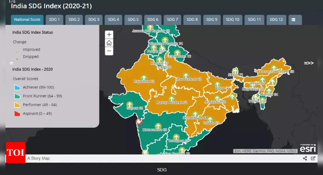
How Policy Maps can be used
The objective of Esri India to develop Policy Maps is to offer data that will help state and corporate policymakers in decision-making. The Policy Maps have been designed to provide meaningful insights for various government functions with a special focus on Sustainable Development Goals (SDGs).
The maps for SDGs provide detailed insights into how India is faring in the achievement of the 17 SDGs. These interactive maps provide data at the granular level and help in analysing the progress achieved in relation to a particular SDG.
“These maps, which have a distinct focus on SDGs, can help in measuring progress as well as identifying relationships between the SDGs. By bridging the gap between data and action, the Policy Maps have the potential to help administrators take smarter decisions for sustainable development,” Kumar added.
Esri India says that the data used in Policy Maps is sourced from authoritative government sources. Apart from providing data on each SDG, these maps can also help policymakers to understand the relationship between various SDGs.
The relationship can be accessed via Relationship Maps, which are created through the dashboard. These maps can help in identifying patterns and understanding how working towards one SDG can lead to creating better conditions for another SDG.
“A strong focus on sustainable development is the need of the hour and the Esri India Policy Maps with an emphasis on SDGs is a well-thought-out and timely initiative in this direction,” Esri India said.
iQoo 11: First look of ‘India’s fastest’ smartphone
For all the latest Technology News Click Here
For the latest news and updates, follow us on Google News.