How to manage your commutes in Google Maps
A daily commute is a difficult thing by nature. You can ease the burden somewhat by learning how to set and manage your commute in Google Maps. Whether you are traveling by car, mass transit, bicycle, or on foot, Maps can help you with your trip. It can warn you of delays and hazards, send directions to others, and even let you take the scenic route by avoiding highways.
Read more: How to measure distance on Google Maps
QUICK ANSWER
To manage your commutes in Google Maps, pin your commute by searching for it in Google Maps and tapping the Pin button at the bottom of the page. Check the length of your route for notification icons and tap on them to see the nature of the incident and its effect on your trip. You can view your transit on the map screen as you travel.
JUMP TO KEY SECTIONS
How to add a commute in Google Maps
First, open Google Maps. Then tap on the search box to pick your destination.
Kevin Convery / Android Authority
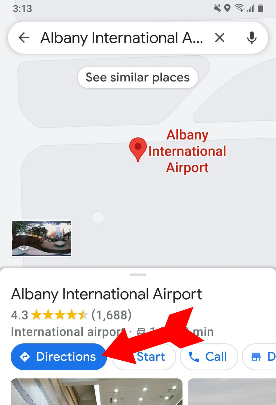
When your destination comes up, tap on Directions.
Kevin Convery / Android Authority
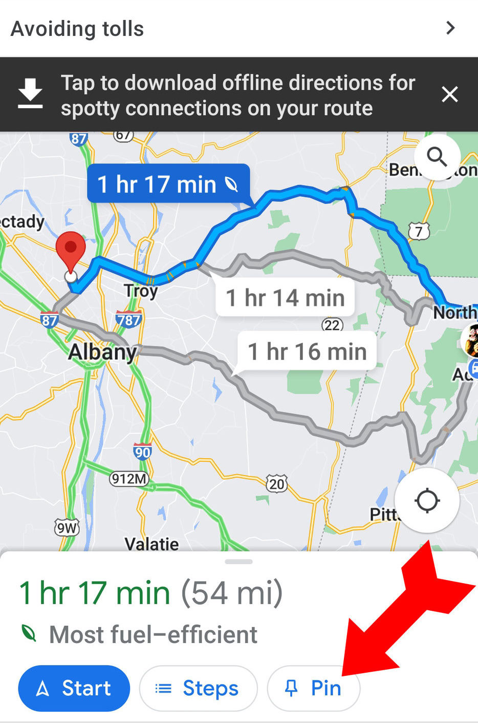
Your route will come up on the map. If there are multiple similar routes you can take, the shortest route will be marked in blue, and slower routes will be marked in gray. If you prefer one of the other routes, tap it on the map. Then tap Pin at the bottom of the screen. Now, the next time you tap on the search window, your commute will come up, and you won’t have to type it in again.
Kevin Convery / Android Authority
How to manage your commutes in Google Maps
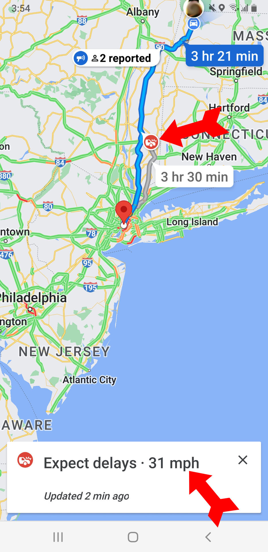
There are many ways Google Maps can help you manage your commute. When you decide on your route and tap Start to begin traveling, the map will display important information about the trip. Many of these notifications will be represented as icons along the route of your trip on the map. These include delays, speed traps, and reports from other travelers. For example, Maps is reporting an accident here along the way (using the “fender bender” icon) that will reduce top speed to 31 MPH.
Kevin Convery / Android Authority
Once it knows where you want to go, other information Maps provides includes mass transit schedules, the length and average time of any walking involved, and road closures affecting your route choices, including those that happen when you are already on the road.
Changing commute settings
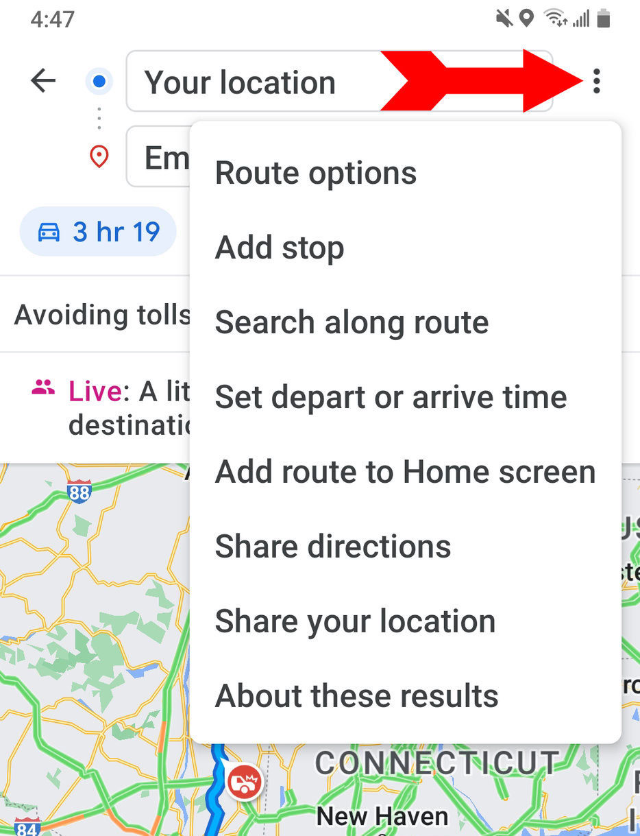
Having your commute entered precisely as you can will yield the best results from Maps. There are several places on the screen where you can adjust your settings. The three-dot menu at the upper right lets you change your route options, add a stop, search along your route (for a certain kind of store, for example, or a motel), and share your directions with fellow travelers or those at your destination who are expecting you.
Kevin Convery / Android Authority
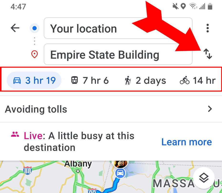
Just tap on the arrows next to your destination to plot a return trip. You can also change the travel method: Auto, Mass Transit, Bicycle, and Walking.
Kevin Convery / Android Authority
Managing route options
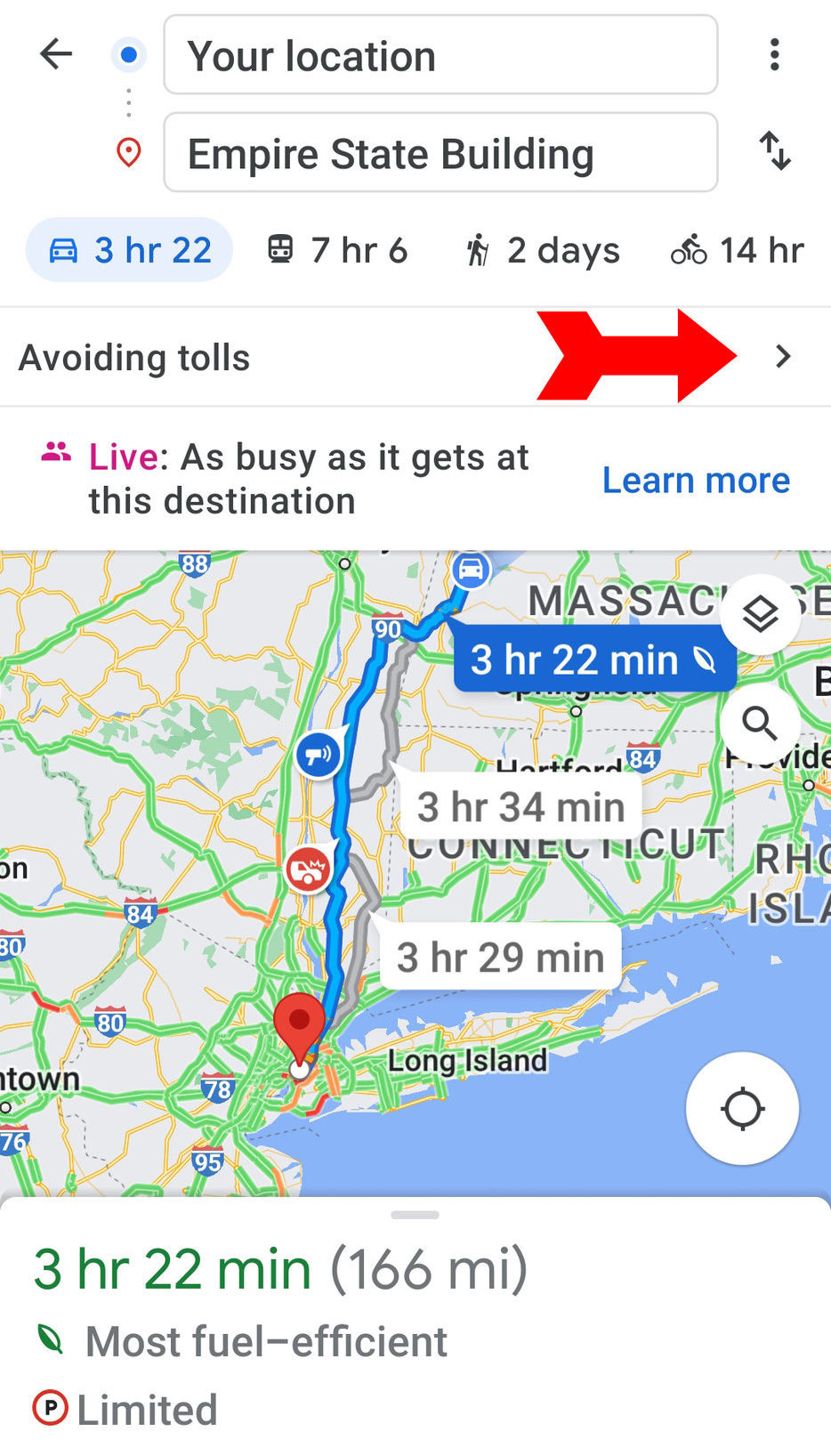
A helpful feature is the ability to prioritize certain aspects of your travel. Here, the screen already tells us the travel time and that parking is limited at the destination. It’s also indicating that the route was chosen with the avoidance of tolls as a priority. If we tap the arrow opposite, we can change these priorities.
Kevin Convery / Android Authority
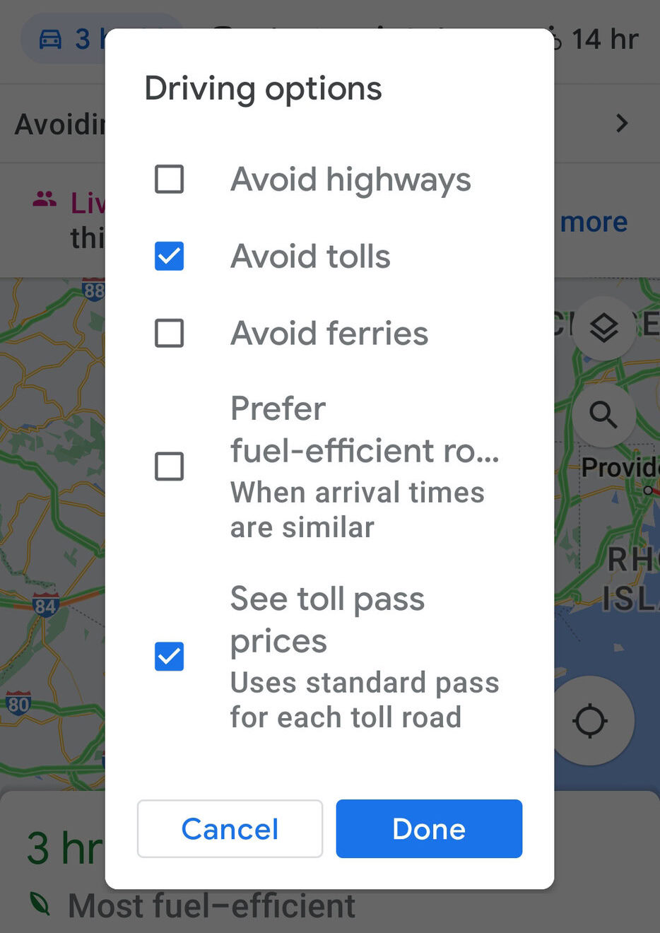
This will bring up a menu of options that will allow us to avoid highways or ferries, and even let us see the relevant toll prices so we can make decisions about travel expenses versus time.
Kevin Convery / Android Authority
How to view your transit
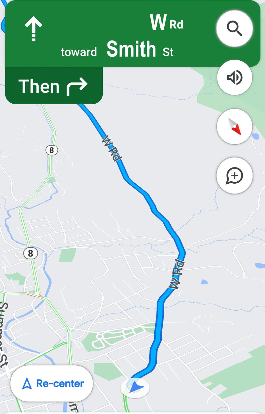
Once you press Start, you will be represented by a blue arrow (unless traveling by mass transit), and your route will be marked in blue (blue dots if you are walking). The exception will be where traffic is reported as heavy (marked in yellow) or very slow (marked in red).
You can see your blue arrow moving along the route as you travel. If you deviate from your route, Maps will redirect you instantly to get you back on the route. Remember that using the audio prompts from Google Maps to guide you if you are driving is safer. Do not watch the screen while your car is in motion.
Kevin Convery / Android Authority
How to check your commute using Google Assistant
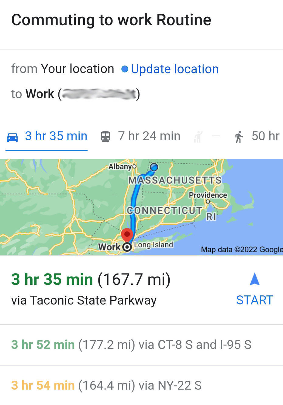
Google Assistant is available for Android phones and tablets, Google Home speakers and displays, and even some TVs. It has many routines available for various daily activities, one of which is the Commuting to work Routine.
The assistant will tell you about your commute (and display it if you are using an Android TV or Google Home display) while outlining the day’s calendar activity and playing any music or news you selected. Google Assistant is available in the Google Play Store.
Kevin Convery / Android Authority
You can store up to nine stops on a single Google Maps trip.
No, Maps will work even if you are not signed in, but you will not have access to all features, such as saving locations and favorite routes.
For all the latest Technology News Click Here
For the latest news and updates, follow us on Google News.
